Gwangju
 |
 |
Its name is composed of the words Gwang meaning "light" and Ju meaning "province". Gwangju was historically recorded as Muju, in which "Silla merged all of the land to establish the provinces of Gwangju, Ungju, Jeonju, Muju and various counties, plus the southern boundary of Goguryeo and the ancient territories of Silla" in the Samguk Sagi. In the heart of the agricultural Jeolla region, the city is also famous for its rich and diverse cuisine.
The city was established in 57 BC. It was one of the administrative centers of Baekje during the Three Kingdoms Period.
In 1929, during the period of Imperial Japanese rule, a confrontation between Korean and Japanese students in the city turned into Gwangju Student Independence Movement, a regional demonstration, which culminated in one of the major nationwide uprisings against Imperial Japanese cruelty during the colonial period.
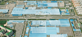
The modern industry was established in Gwangju with the construction of a railway to Seoul. Some of the industries that took hold include cotton textiles, rice mills and breweries. Construction of a designated industrial zone in 1967 encouraged growth in industry, especially in the sectors linked to the automobile industry.
In May 1980, peaceful demonstrations took place in Gwangju against Chun Doo-hwan, leader of the military coup d'état of 12 December 1979. The demonstrations were suppressed by military forces, including elite units of the Special Operations Command. The situation escalated after a violent crackdown, resulting in the Gwangju Uprising, where civilians raided armories and armed themselves. By the time the uprising was suppressed 9 days later, many hundreds of civilians and several police forces / soldiers were dead. After civilian rule was reinstated in 1987, a national cemetery was established to honor the victims of the incident. Now the South Korean constitution admits the Gwangju Uprising as a root of South Korean democracy.
In 1986, Gwangju separated from Jeollanam-do to become a Directly Governed City (Jikhalsi), and then became a Metropolitan City (Gwangyeoksi) in 1995.
Due to a variety of factors, including the ancient rivalry between Baekje and Silla, as well as the biased priority given to the Gyeongsang region by political leaders in the 2nd half of the 20th century, Gwangju has a long history of voting for left-leaning politicians and is the main stronghold for the liberal Democratic Party of Korea along with its predecessors, as well as the progressive Justice Party.
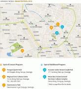
Gwangju held many sports events such as 2002 FIFA World Cup, 2015 Summer Universiade, 2019 World Aquatics Championships.
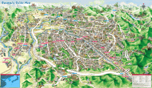
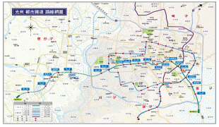
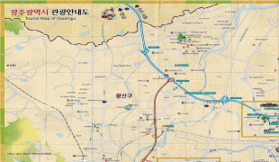
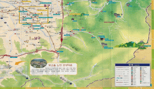
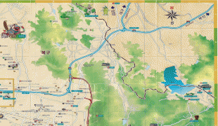
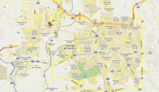
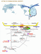
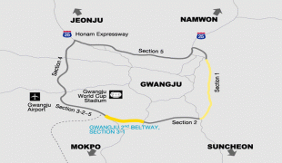
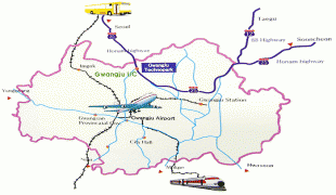
Map - Gwangju
Map


Country - South_Korea
 |
 |
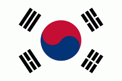
| Flag of South Korea | |
The Korean Peninsula was inhabited as early as the Lower Paleolithic period. Its first kingdom was noted in Chinese records in the early 7th century BCE. Following the unification of the Three Kingdoms of Korea into Silla and Balhae in the late 7th century, Korea was ruled by the Goryeo dynasty (918–1392) and the Joseon dynasty (1392–1897). The succeeding Korean Empire (1897–1910) was annexed in 1910 into the Empire of Japan. Japanese rule ended following Japan's surrender in World War II, after which Korea was divided into two zones; a northern zone occupied by the Soviet Union and a southern zone occupied by the United States. After negotiations on reunification failed, the southern zone became the Republic of Korea in August 1948 while the northern zone became the communist Democratic People's Republic of Korea the following month.
Currency / Language
| ISO | Currency | Symbol | Significant figures |
|---|---|---|---|
| KRW | South Korean won | â‚© | 0 |
| ISO | Language |
|---|---|
| EN | English language |
| KO | Korean language |